The Nazca Lines: Drawings for the Sky
200 BC · event
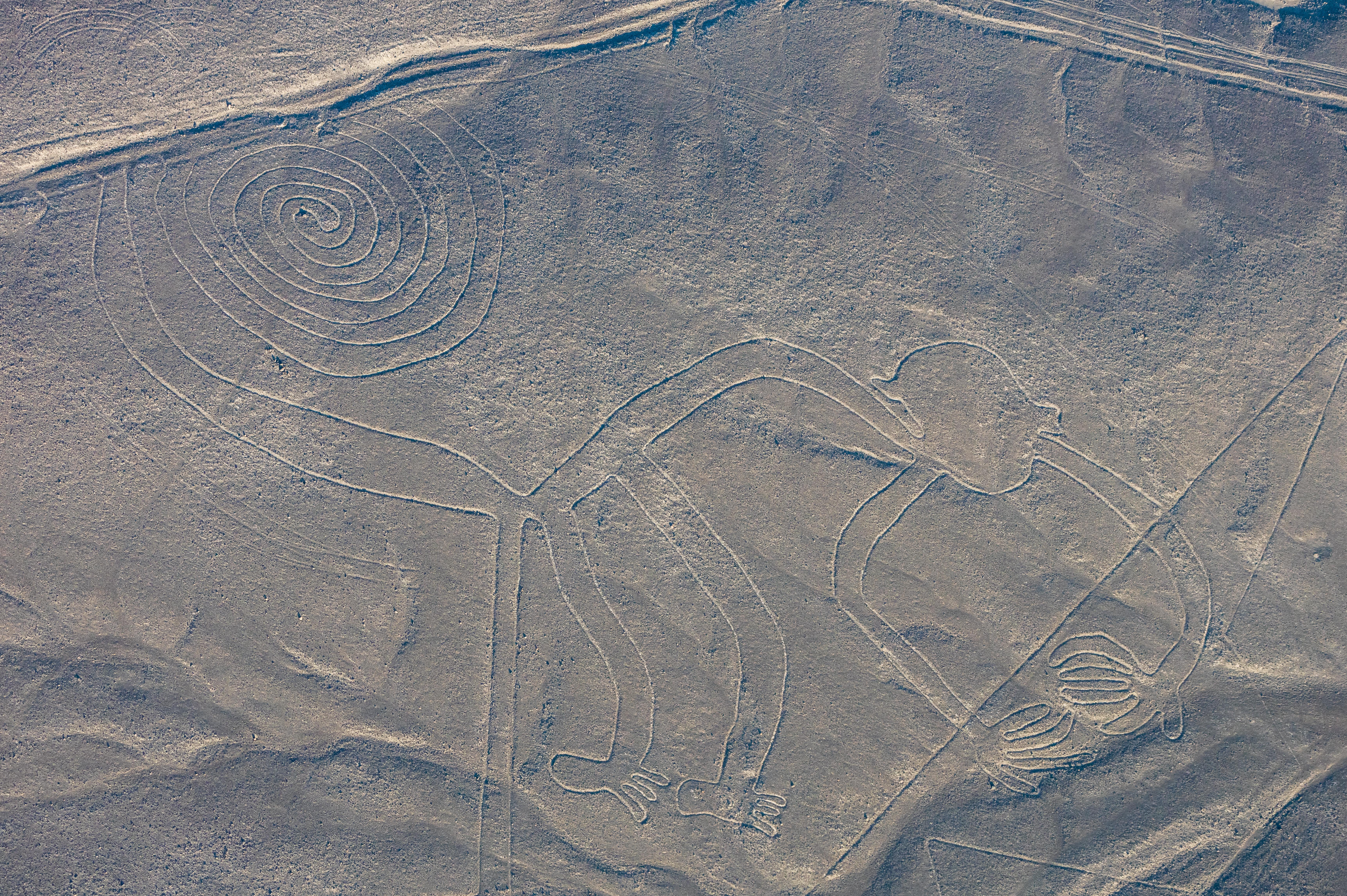
In the dry coastal desert of southern Peru, between the valleys of the Nazca and Ingenio rivers, the ground itself has been drawn on. Hundreds of figures and many thousands of straight lines and geometric shapes stretch across some five hundred square kilometres of stony plateau. Among them are a hummingbird, a monkey with a spiral tail, a spider, a condor with wings tens of metres across, and a whale. From the ground they are almost invisible. From a hill or an aircraft they resolve into single confident drawings.
The technique was simple and patient. The desert surface is covered with reddish stones darkened by iron oxide, and beneath them lies pale yellow ground. By lifting the stones and piling them along the edges, the makers left a light line that the local climate, one of the driest and least windy on Earth, has preserved for around two thousand years. Most of the figures were made by the Nazca culture between roughly 200 BC and 600 AD, with some earlier work attributed to the Paracas people.
Why they were made is still argued. The German mathematician Maria Reiche spent decades on the plateau, measuring, mapping and defending the lines from traffic, and proposed astronomical alignments. Other researchers point to water. In a desert where survival depends on underground channels, many lines lead toward sources of water, and the figures may have been walked in procession as part of ceremonies asking for rain.
The lines were inscribed on the UNESCO World Heritage list in 1994, and new figures are still being found, now with drones and computer analysis of aerial images. They are also fragile. A single vehicle track can last for centuries. What survives is a message written for a viewpoint their makers never had, and a reminder that people have always tried to speak to something larger than themselves.